The relief and its forms
The landscape of the Krkonoše Mountains is a rich testimony to the busy mountain-building processes of the distant past. There are remnants of ancient Tertiary relief, evidence of the intense modelling of rivers and streams in the period after the Tertiary Alpine folding, as well as a landscape modelled by frost, ice and snow in the Quaternary period. For many centuries, however, the appearance of the highest Bohemian mountains has also been influenced by man.
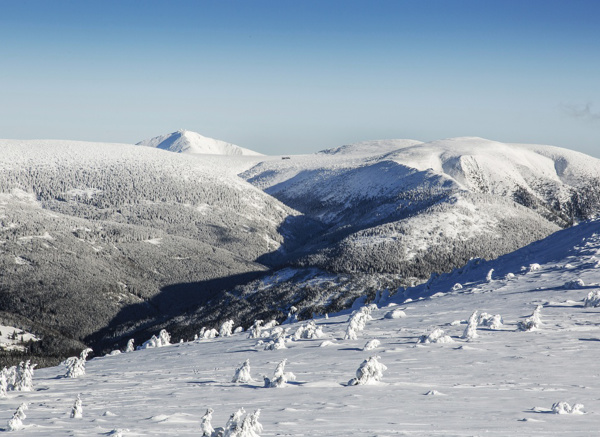
The Krkonoše ridges are stretched in a northwest-southeast direction. They are formed by two distinct parallel ranges. The higher and almost 30 km long Silesian Ridge (also called the main or border ridge) forms the highest Krkonoše peaks. From west to east they are Szrenica, Violík, Vysoké Kolo, Malý Šišák, Stříbrný hřbet, Sněžka, Svorová hora. Somewhat lower is the Bohemian Ridge (also internal), divided by a deep notch of the Elbe above Špindlerův Mlýn. In the western part, its highest peaks include Plešivec, Lysá hora, Kotel, Krkonoše and Medvědín, while in the eastern part there are Kozí hřbety, Luční and Studniční hora.
The Krkonoše mountain ranges are somewhat lower and mainly southward-running mountain ranges from the two main ridges, e.g. the range of Kapradník, Čertova hora, Vlčí ridge, the range of Žalý and the most prominent range of Zadní Planina. From Sněžka runs the spur of Růžové hory, followed by the spurs of Jelení Hora, Pomezní hřeben Ridge and Dlouhý hřeben Ridge and then the spur of Rýchory with Žacléřský hřeben Ridge.
Karling Sněžka is the special needle-like shape of the 1,603 m high mountain. It was formed during the ice ages, when the rounded, from the mist rising knag of hard rock was affected by the backward erosion of the Úpa, Lomniczka and Jelení potok Creek. That, together with glacial erosion (glaciers adjoined the slopes of Sněžka on three sides). Thus, they formed a pointed triangular formation, technically called a karling.
Glacial cirques are kettle-shaped rock amphitheatres and depressions at the ends of mountain valleys, from where the glaciers originated. They were formed by reverse and deep erosion of glaciers and frost weathering of rock faces. There are 35 of these formations in the Krkonoše Mountains (17 on the Polish side), testifying to the extent of ancient glaciation, but only 14 of them are significant. In local nomenclature, they are known as pits or kettles - the Velká Studniční jáma Pit and Malá Studniční jáma Pit, the Úpská jáma Pit, Kocioł Łomniczki, Kocioł Wielkého a Małého Staw, Czarny Kocioł, Wielki a Mały Kocioł Śnieżny, the Velká Studniční jáma Pit and the Malá Studniční jáma Pit, and the trio of pits at the end of Labský Důl - the Harrachova jáma Pit, Pančavská jáma Pit and Navorská jáma Pit.
Glacial valleys (trogs) were formed during the repeated glaciation of Europe in the older Quaternary in the rocky ends of some Krkonoše mountain valleys. The glaciers, by their weight and pressure, ground and reshaped the originally sharply incised narrow mountain river valleys with a V-shaped transverse profile into broad glacial valleys with a U-shaped transverse profile.